|
Create Cartographic Partitions |
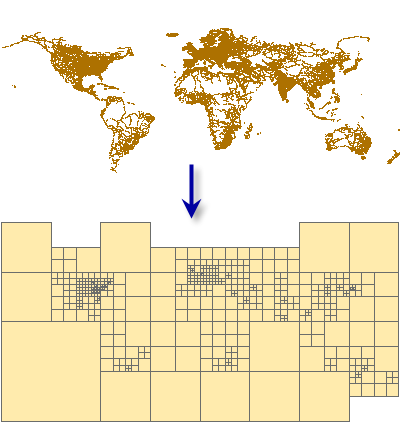
Creates a mesh of polygon features that cover the input feature class where each polygon encloses no more than a specified number of input features, determined by the density and distribution of the input features.
The resulting partition feature class is ideally suited for the Cartographic Partitions geoprocessing environment setting. The Cartographic Partitions environment setting dictates to certain generalization or conflict-resolution geoprocessing tools to load and process input features by partition. These tools operate contextually, meaning that multiple features, possibly from multiple themes, must be loaded simultaneously. Memory limitations are encountered with large datasets. Partitioning allows large datasets to be processed by these tools in portions sequentially.
This tool creates a polygon feature class designed to be used in the Cartographic Partitions geoprocessing environment setting. Tools that honor this environment setting process input features in portions defined by the partition polygons to avoid exceeding memory limitations. The following tools honor the Cartographic Partitions environment setting:
- The Aggregate Polygons tool
- The Collapse Road Detail tool
- The Delineate Built-Up Areas tool
- The Detect Graphic Conflict tool
- The Merge Divided Roads tool
- The Resolve Building Conflicts tool
- The Resolve Road Conflicts tool
- The Thin Road Network tool
Input features should correspond to the features that you intend to process together for multiscale display. For example, if you intend to use the Thin Road Network tool to process a feature class containing streets together with another containing highways, enter both of these as inputs to the Create Cartographic Partitions tool to create partitions that are relevant to the distribution and density of both datasets considered together.